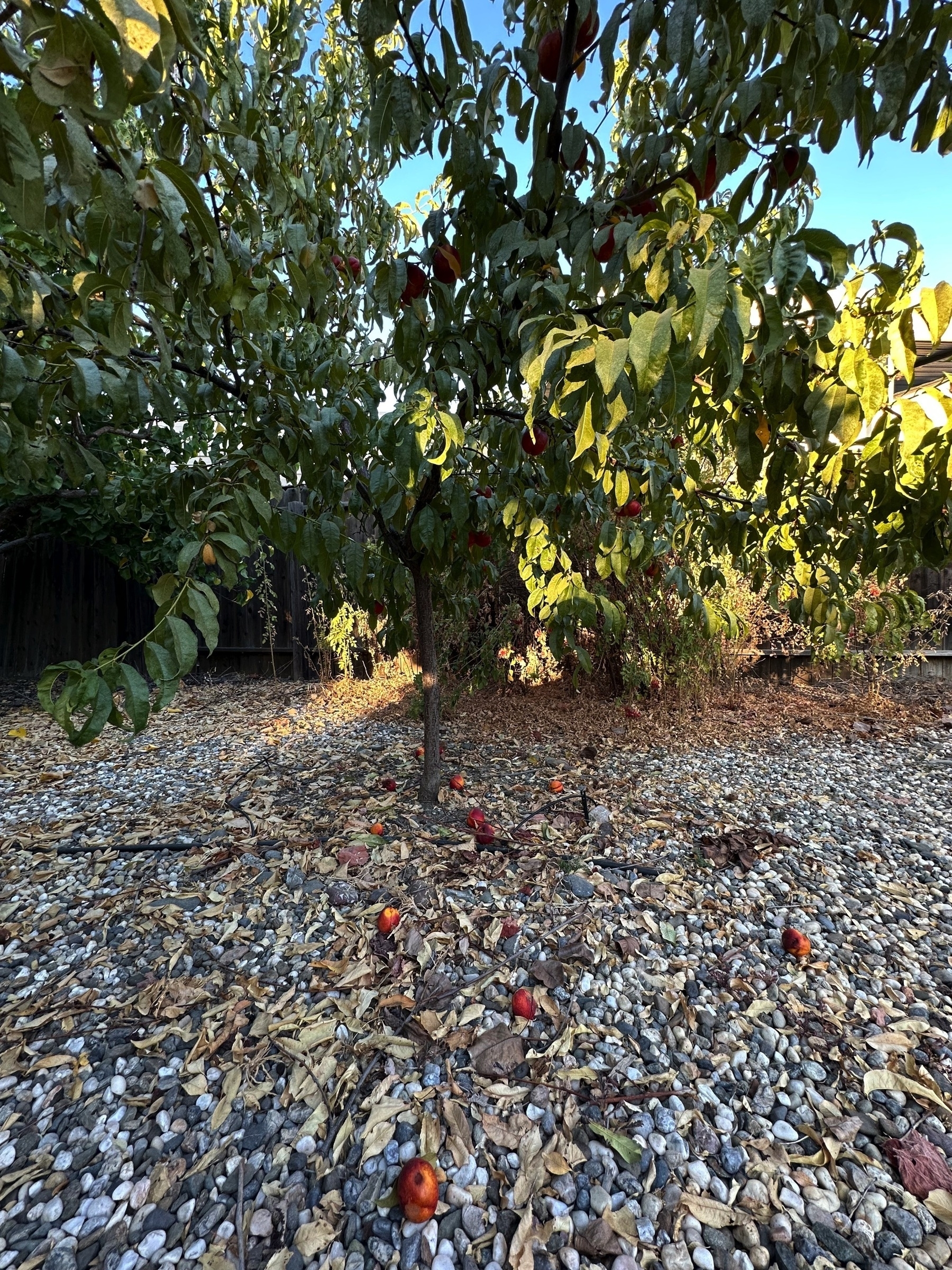
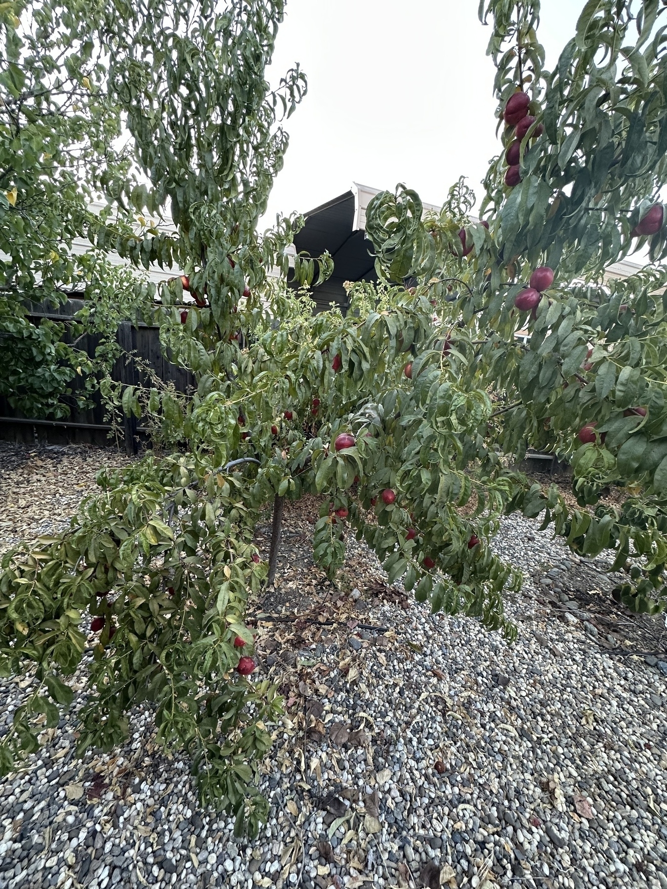
I think this is the last nectarine harvest. About 6 pounds. The shield bugs were showing up and nectarines were dropping fast from wind and bird pecks :-( They were effortlessly plucked off the tree. Next harvest: Asian pears! #HomeOrchard #Nectarines #Yarden
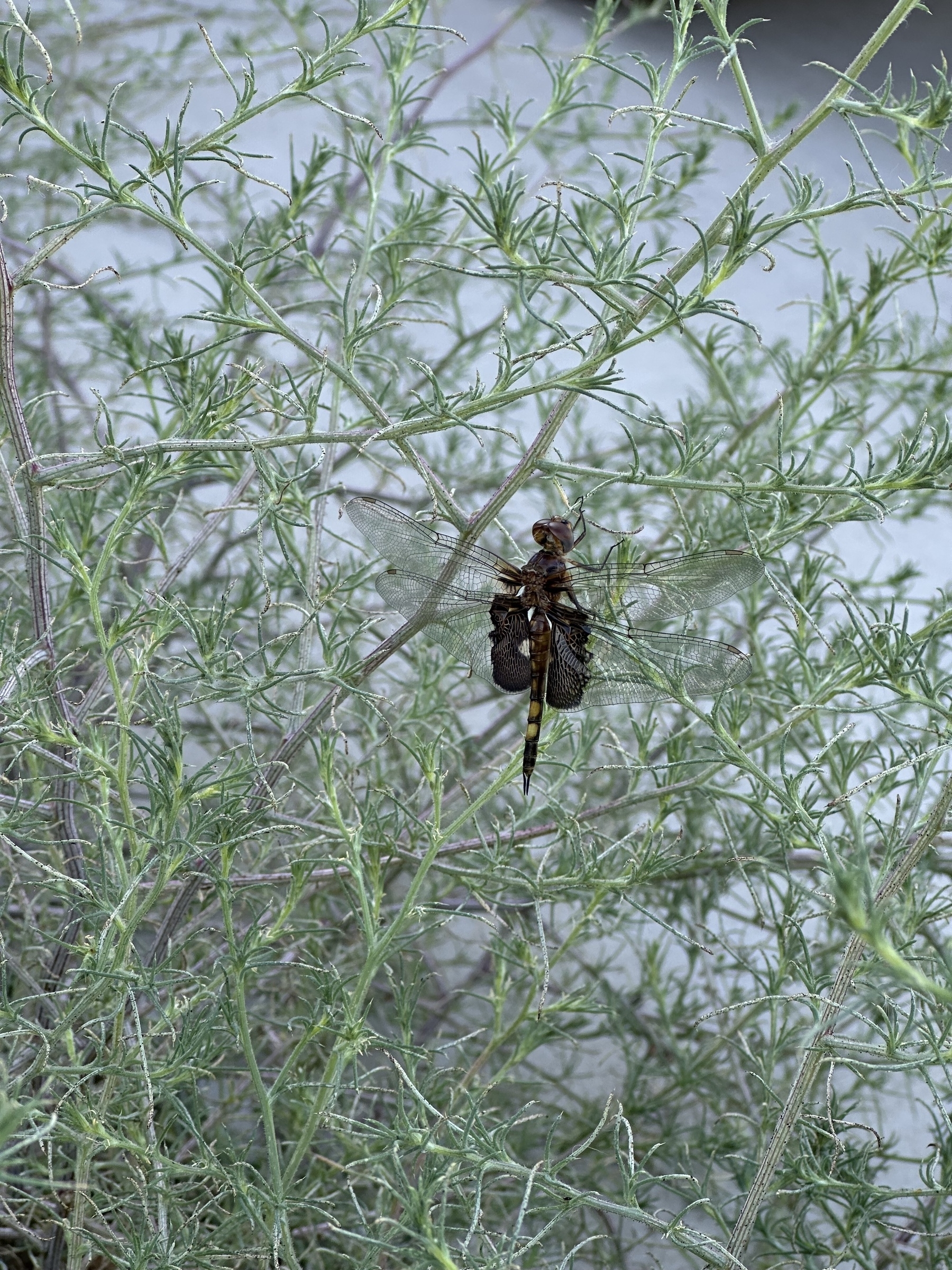
Black Saddlebags spotted on my walk just now #BlackSaddlebags #Insects #InsectPhotography
Here’s our Northern California seismograph for the M8.8 earthquake at Kamchatka. Impressive. Took about 10 minutes to reach our town. Not sure what the signal was 15 minutes before it though.
Edit: Looking at the timing, the 15-minute earlier signal was likely me coming home from work & closing the front security door #Earthquake #RaspberryShake #Seismograph
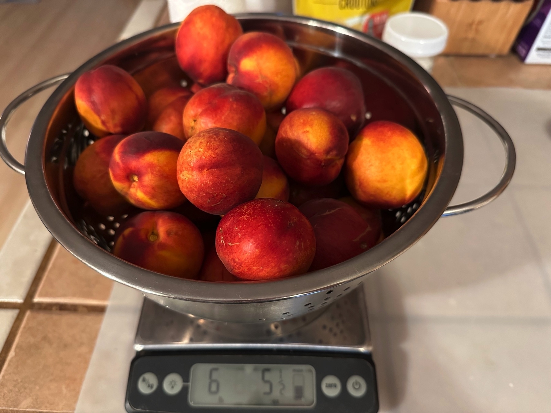
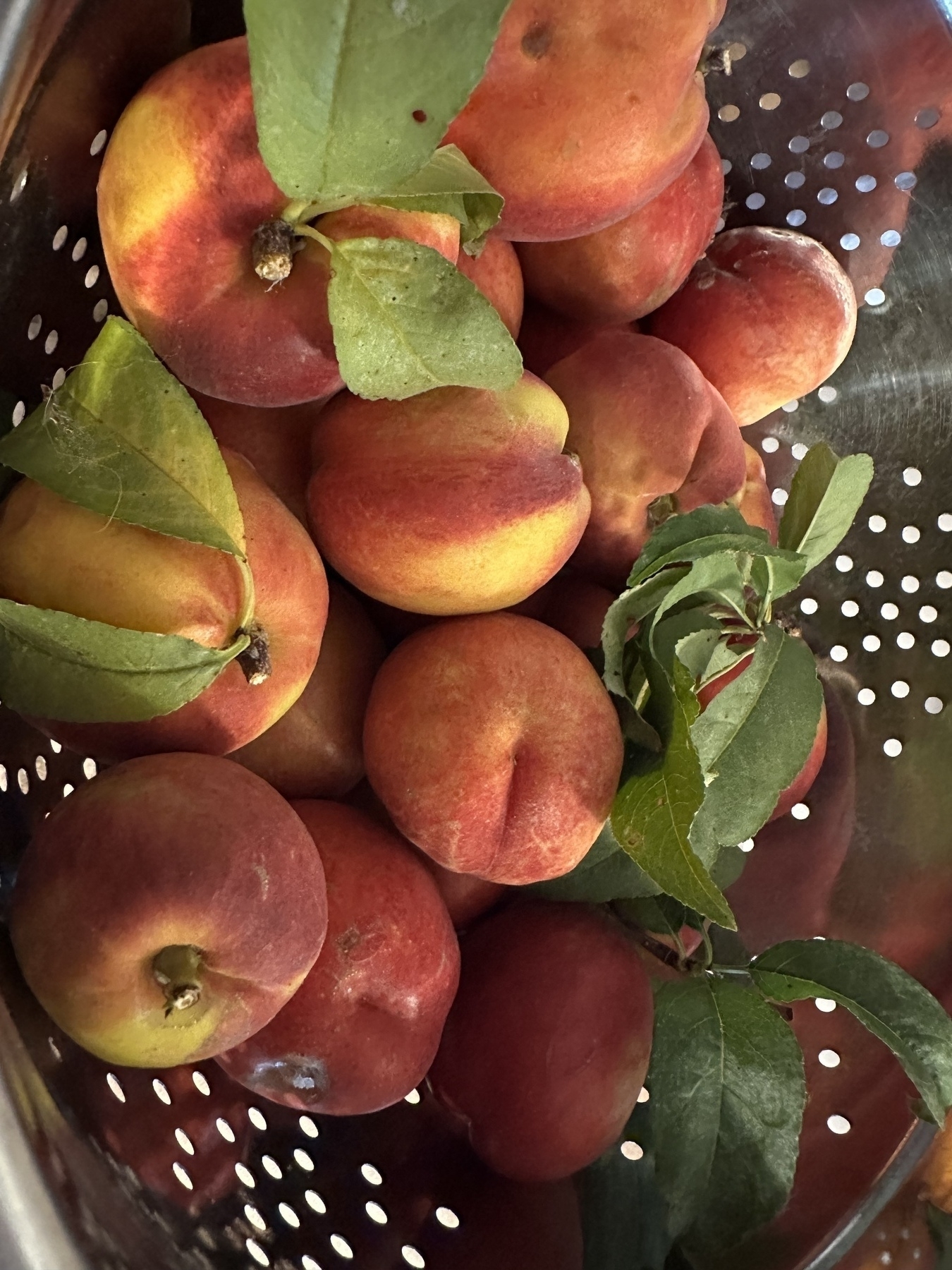
Another nectarine harvest. This time, 4 pounds. Smelling more fragrant this time! A few came off with a tug (yellower stems) but most still need shears. Also, our milkweed has busted open their pods and omg the tufts are so soft! #HomeOrchard #Nectarines #Milkweed #Yarden
Redwoods, likely grown together, on the Trillium Falls Trail at Redwood National and State Parks #ThickTrunkTuesday #RedwoodsNP #Redwoods #NorCalCoast2025 #Fujifilm #SOoC
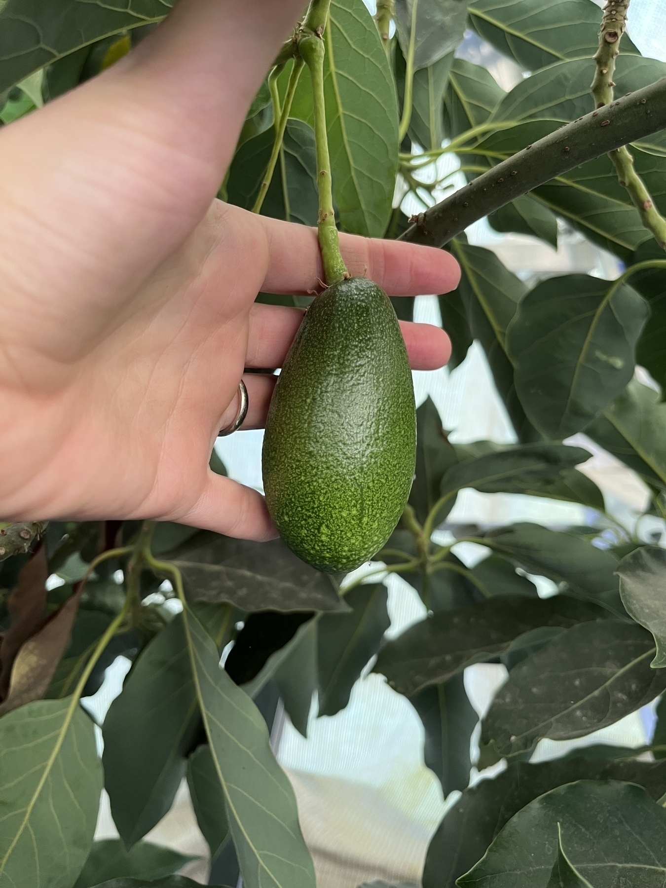
Our lone Mexicola avocado! Maybe this’ll be its first fruit to make it to maturity? It’s a long slog. #HomeOrchard #Avocado #Yarden
Started our Nectarine harvest. Last year they got bug infested but not this year. So far. One branch got majorly overloaded 😬 so I harvested it first. #HomeOrchard #Yarden
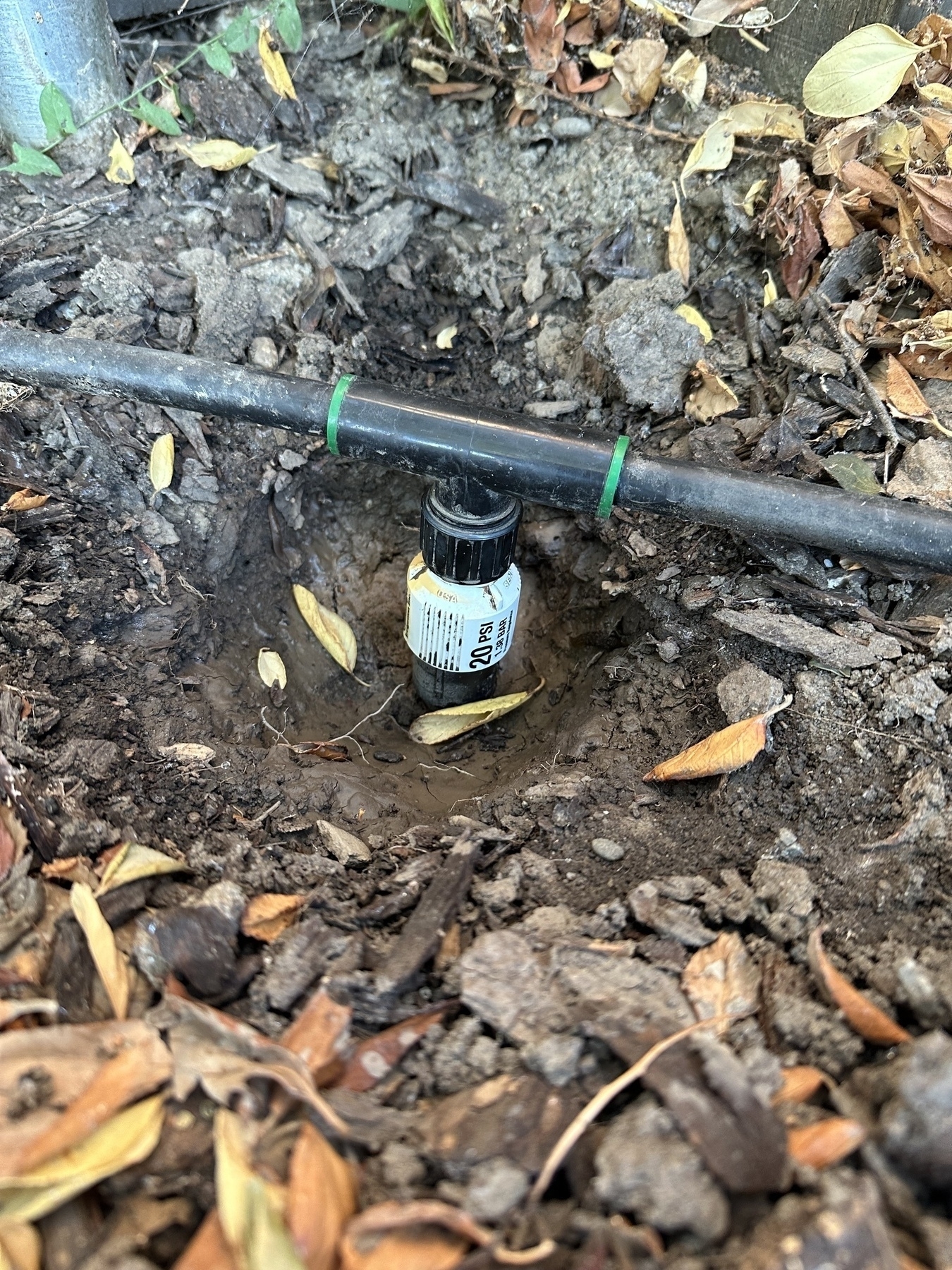
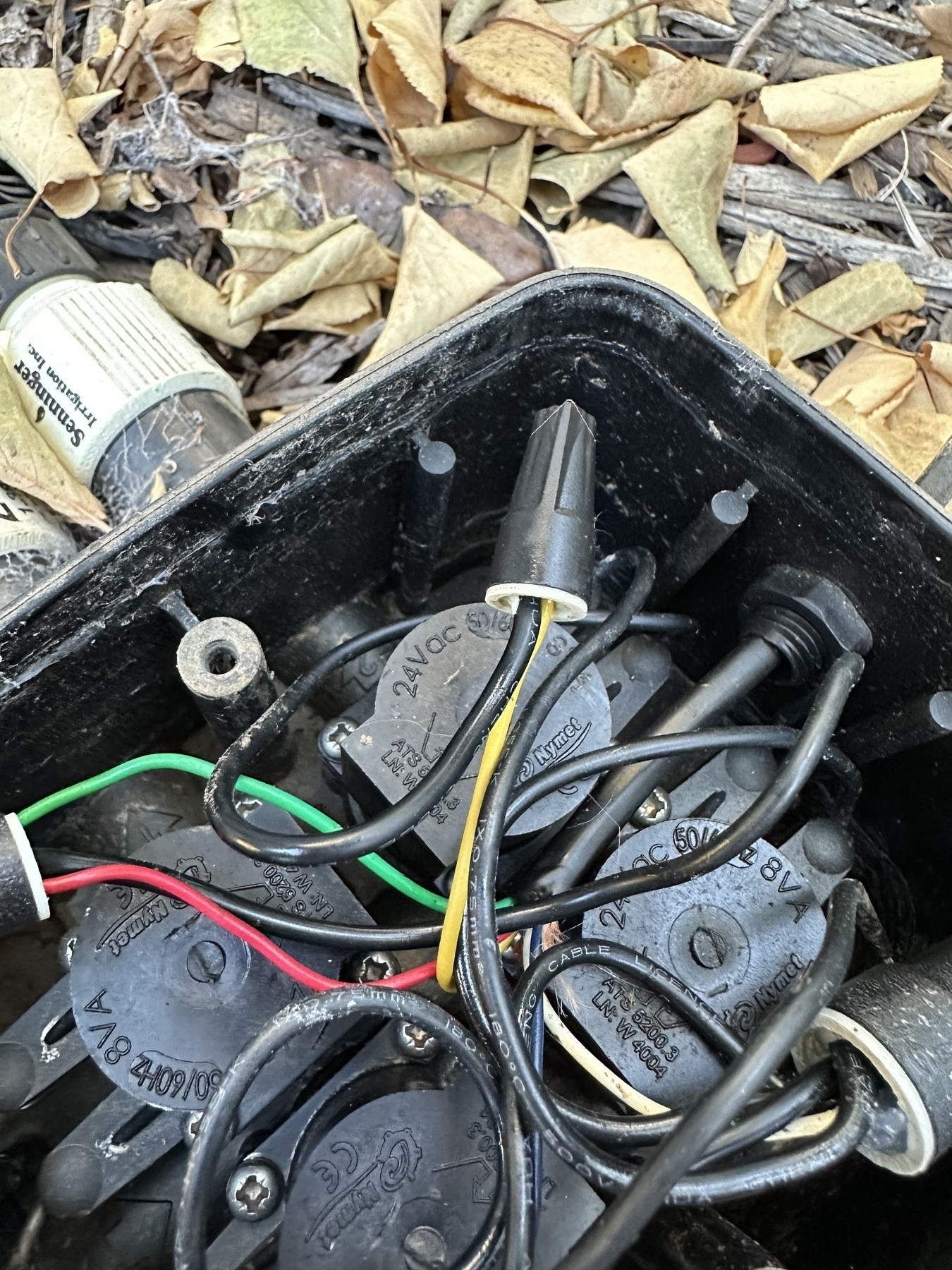
Outdoor backyard irrigation system fixed & weeds removed. That’s it for outdoors stuff! #Yarden #CaWx #DripIrrigation
That’s a beak-full. Took some time for them to swallow the whole fish. #GreatEgret #Birds #BirdPhotography #NorCalCoast2025 #Fujifilm #SoOC
Who wants grubs? #AmericanRobin #Birds #BirdPhotography #NorCalCoast2025 #Fujifilm #SoOC
“Bruh!” (as captioned by a friend) #BlackCappedChickadee #Birds #BirdPhotography #NorCalCoast2025 #Fujifilm #SoOC
Fortunately a small 50-acre wildfire, north of Orland CA, in Stony Creek, is under control, but overnight a mobile home park had to be evacuated. Hopefully this will encourage Orland city council to tackle the invasive tamarisk issue in Stony Creek #CreekFire #WildFires #CaWx